
Winter Storm System Brings Warnings and Advisories Across 14 States
A significant winter storm system is currently affecting the central and eastern United States, prompting winter storm warnings in 14 states. The National Weather Service has issued a winter storm warning, which indicates at least six inches of snow is expected to fall in 12 hours, or eight inches in 24 hours, or half an inch of sleet is expected to accumulate.
Understanding the Severity of Winter Storm Warnings
A winter storm warning is more serious than a winter weather advisory, which indicates 3 to 5 inches of snow in 12 hours. The National Weather Service has also issued winter storm watches, which indicate the possibility of a winter storm. The latest map shows winter weather advisories in place in 28 states and flash flood watches in 11 states.
Current Weather Conditions and Forecasts
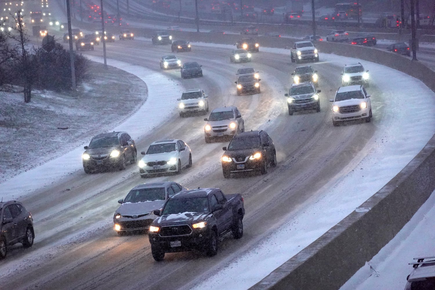
The National Weather Service website provides state-by-state and more localized forecasts. A forecast discussion published by the NWS Weather Prediction Center indicates that "bursts of heavy snow, accumulating at times to an inch per hour, may lead to hazardous driving conditions and disrupt travel." Heavier snow rates are expected to develop in time for the evening rush hour in cities such as Milwaukee, Chicago, Grand Rapids, and Detroit.
Regional Weather Outlook
While some regions may experience a winter wonderland, the weather forecast indicates a significant chance of wintry mix, including snow, sleet, and freezing rain. The weather service cautions that "power outages and tree damage are likely" and advises that traveling unless necessary is the safest option.
Origin of the Winter Storm
The winter storm is caused by the southerly movement of a high-pressure system from the Arctic, bringing cold weather across the contiguous United States. Moisture from the Gulf of Mexico is moving north, mixing with the cold air in a low-pressure area, triggering a winter storm.
Historical Context and Severe Weather Risk
Historical data from the Storm Prediction Center in Norman, Oklahoma indicates that the risk of severe weather for this point in February is fairly rare, about 1% over the past 30 years. However, the winter season has been productive, with the polar vortex bringing subzero temperatures and blizzard conditions across the Great Lakes and Mid-Atlantic states.
Additional Severe Weather Risks
Severe storms are expected on the southern side of the system, affecting the Gulf states from east Texas to west Florida, with temperatures slightly warmer. Thunderstorms are expected across the region and as far north as Oklahoma in the west to West Virginia in the east. The most severe storms will be concentrated in southern Alabama and Mississippi.
Regional Weather Risks and Advisories
A moderate risk of excessive rainfall is forecast for Southern California through Thursday, with a slight risk in Northern and Central California today. The recent wildfires in California create a serious risk of mudslides. New Mexico is the only state without any weather warnings or advisories, aside from South Carolina and Florida, which have coastal advisories in place.
Key Takeaways
- Winter storm warnings have been issued in 14 states across the central and eastern United States.
- The National Weather Service has also issued winter storm watches and advisories.
- Heavier snow rates are expected to develop in time for the evening rush hour in several cities.
- The weather forecast indicates a significant chance of wintry mix, including snow, sleet, and freezing rain.
- Traveling unless necessary is advised due to the risk of hazardous driving conditions and power outages.
- The origin of the winter storm is attributed to the southerly movement of a high-pressure system from the Arctic.
- Severe weather risks include thunderstorms, heavy rainfall, and mudslides.
Source Link